![C-MAP 4D Lakes NA-D073 North East [M-NA-D073-MS]](http://boatpartsdepot.com/cdn/shop/files/op_blade_hero_icast2024_1.png?v=1758553857&width=3840)
![C-MAP 4D Lakes NA-D073 North East [M-NA-D073-MS]](http://boatpartsdepot.com/cdn/shop/files/lumitec.png?v=1758638733&width=3840)
![C-MAP 4D Lakes NA-D073 North East [M-NA-D073-MS]](http://boatpartsdepot.com/cdn/shop/files/garmin.webp?v=1758640530&width=3840)
![C-MAP 4D Lakes NA-D073 North East [M-NA-D073-MS]](http://boatpartsdepot.com/cdn/shop/files/Untitled_design_-_2024-08-27T113233.566.png?v=1724740371&width=3840)
![C-MAP 4D Lakes NA-D073 North East [M-NA-D073-MS]](http://boatpartsdepot.com/cdn/shop/files/kraken.jpg?v=1758232543&width=3840)
![C-MAP 4D NA-940 Cape Cod, Long Island & Hudson River [M-NA-D940-MS]](http://boatpartsdepot.com/cdn/shop/files/50308XL.jpg?v=1723123893&width=3840)
![C-MAP 4D NA-947 Coatzacoalcos, MX to Honduras Bay, GT [M-NA-D947-MS]](http://boatpartsdepot.com/cdn/shop/files/50316XL.jpg?v=1723123955&width=3840)
![C-MAP 4D NA-D932 Lake Huron and Georgian Bay [M-NA-D932-MS]](http://boatpartsdepot.com/cdn/shop/files/50286XL.jpg?v=1723123741&width=3840)
![C-MAP 4D NA-D933 Lake Erie and Lake St Clair [M-NA-D933-MS]](http://boatpartsdepot.com/cdn/shop/files/50287XL.jpg?v=1723123750&width=3840)
![C-MAP 4D NA-D934 Lake Ontario and Trent Severn [M-NA-D934-MS]](http://boatpartsdepot.com/cdn/shop/files/50289XL.jpg?v=1723123768&width=3840)
![C-MAP 4D NA-D935 St Lawrence River [M-NA-D935-MS]](http://boatpartsdepot.com/cdn/shop/files/50290XL.jpg?v=1723123776&width=3840)
![C-MAP 4D NA-D936 Gulf of St. Lawrence [M-NA-D936-MS]](http://boatpartsdepot.com/cdn/shop/files/50292XL.jpg?v=1723123794&width=3840)
![C-MAP 4D NA-D937 Newfoundland [M-NA-D937-MS]](http://boatpartsdepot.com/cdn/shop/files/50294XL.jpg?v=1723123812&width=3840)
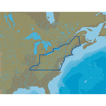
![C-MAP 4D NA-D939 Passamaquoddy Bay to Block Island [M-NA-D939-MS]](http://boatpartsdepot.com/cdn/shop/files/50301XL.jpg?v=1723123865&width=3840)
![C-MAP 4D NA-D941 Block Island to Norfolk [M-NA-D941-MS]](http://boatpartsdepot.com/cdn/shop/files/50310XL.jpg?v=1723123902&width=3840)
Built for the Water
Lighting the Way Below – Enhancing Every Dive
Underwater Glow, Unmatched Visibility
![C-MAP 4D Lakes NA-D073 North East [M-NA-D073-MS]](http://boatpartsdepot.com/cdn/shop/files/70008XL_180x.jpg?v=1723181309)
4D Lakes NA-D073 North East
C-MAP charts have long been held in high regard by boaters because they combine aesthetically pleasing vector electronic charts with reliable sources. With the backing of Jeppesen's parent company Boeing, a well-respected multibillion dollar global company, boaters can be assured that C-MAP charts are of the highest standard.
C-Map 4D will provide boaters with charts packed additional features such as raster chart views or Satellite images* to maximize situational awareness.
Coverage Area:
Lakes and major rivers of North East region of USA, including states of: Maine, Vermont, New York, New Jersey, New Hampshire, Massachuesetts, Connecticut, Delaware, Maryland, Virginia, West Virginia, Kentucky, Ohio, Pennsylvannia. Includes coastal coverage of Atlantic Ocean and Chesapeake Bay, Hudson River, Cape Cod, Long Island Sound, more.
Specifications:

RECENTLY VIEWED PRODUCTS
![Navionics NASA004L - Mexico, Caribbean to Brazil - Navionics+ [010-C1364-30]](http://boatpartsdepot.com/cdn/shop/files/92603XL.jpg?v=1723564691&width=3840)
![Humminbird LakeMaster VX - Wisconsin [601010-1]](http://boatpartsdepot.com/cdn/shop/files/96681XL.jpg?v=1723588987&width=3840)
![Navionics NAUS012R - Canada, East Great Lakes - Navionics+ [010-C1466-30]](http://boatpartsdepot.com/cdn/shop/files/102653XL.jpg?v=1723625768&width=3840)
![Garmin Navionics+ NSUS007R U.S. East [010-C1291-20]](http://boatpartsdepot.com/cdn/shop/files/92673XL.jpg?v=1723565241&width=3840)
![Navionics NASA010R - Central America Caribbean - Navionics+ [010-C1459-30]](http://boatpartsdepot.com/cdn/shop/files/101640XL.jpg?v=1723618772&width=3840)
![Garmin Navionics+ NSSA010R Central America Caribbean [010-C1451-20]](http://boatpartsdepot.com/cdn/shop/files/102666XL.jpg?v=1723625864&width=3840)
![Navionics NASA005L - Chile, Argentina Easter Island - Navionics+ [010-C1365-30]](http://boatpartsdepot.com/cdn/shop/files/92604XL.jpg?v=1723564699&width=3840)
![C-MAP 4D Lakes NA-D073 North East [M-NA-D073-MS]](http://boatpartsdepot.com/cdn/shop/files/Untitled_design_-_2024-08-28T110403.265.png?v=1724825283&width=3840)


![C-MAP 4D NA-D061 Great Lakes St Lawrence Seaway -microSD/SD [M-NA-D061-MS]](http://boatpartsdepot.com/cdn/shop/files/76124XL.jpg?v=1723204210&width=3840)
![Humminbird LakeMaster Aerial Satellite View - Louisiana Delta [600050-1]](http://boatpartsdepot.com/cdn/shop/files/62442XL.jpg?v=1723159566&width=3840)
![Humminbird Coastmaster Chart [601015-1]](http://boatpartsdepot.com/cdn/shop/files/85270XL.jpg?v=1723530755&width=3840)
![Humminbird Coastmaster Chart [601015-1]](http://boatpartsdepot.com/cdn/shop/files/85270BXL.jpg?v=1723530757&width=3840)
![Garmin BlueChart g3 Vision HD - VUS513L - Jacksonville - Bahamas - microSD/SD [010-C0742-00]](http://boatpartsdepot.com/cdn/shop/files/30408XL.jpg?v=1723085561&width=3840)
![Garmin BlueChart g3 Vision HD - VUS030R - Southeast Caribbean - microSD/SD [010-C0731-00]](http://boatpartsdepot.com/cdn/shop/files/30379XL.jpg?v=1723085391&width=3840)


